Log in
All resources
Create a design
34,645 Free Images of 1650 Maps
maps in the library of congress
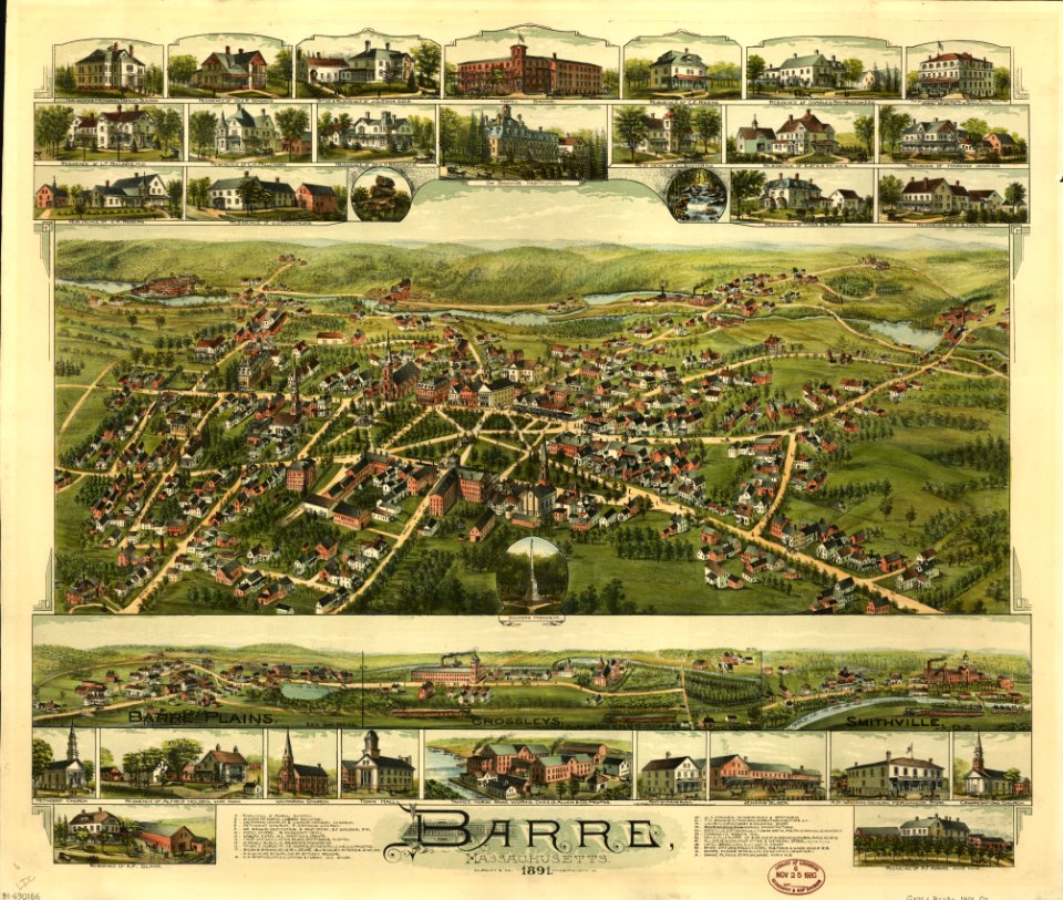
massachusetts
o. h. bailey
charts and maps of the royal museums greenwich
1682 maps
french-language maps
old maps of newfoundland
maps of newton
albert ruger
old maps of massachusetts
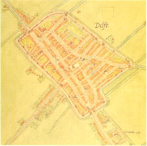
maps by jacob van deventer
old maps of delft
collections of staatsbibliothek bamberg
1602 maps
french-language maps
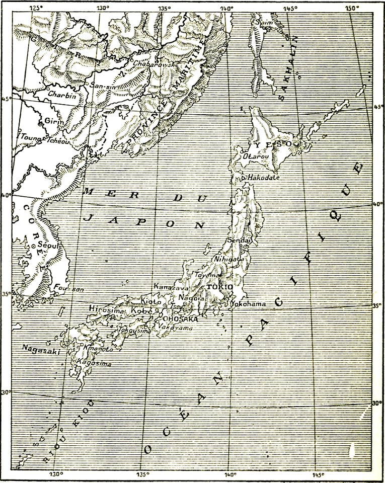
old maps of japan
matthäus merian
1672 maps
nikolskoe (berlin)
1837 maps
old maps of french polynesia
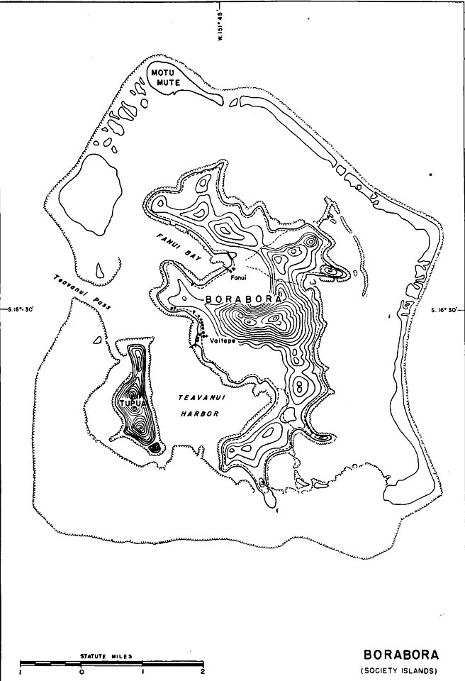
maps of bora bora
maps by willem and johannes blaeu
maps of montfoort
maps of polders in north holland
maps of haarlemmermeer
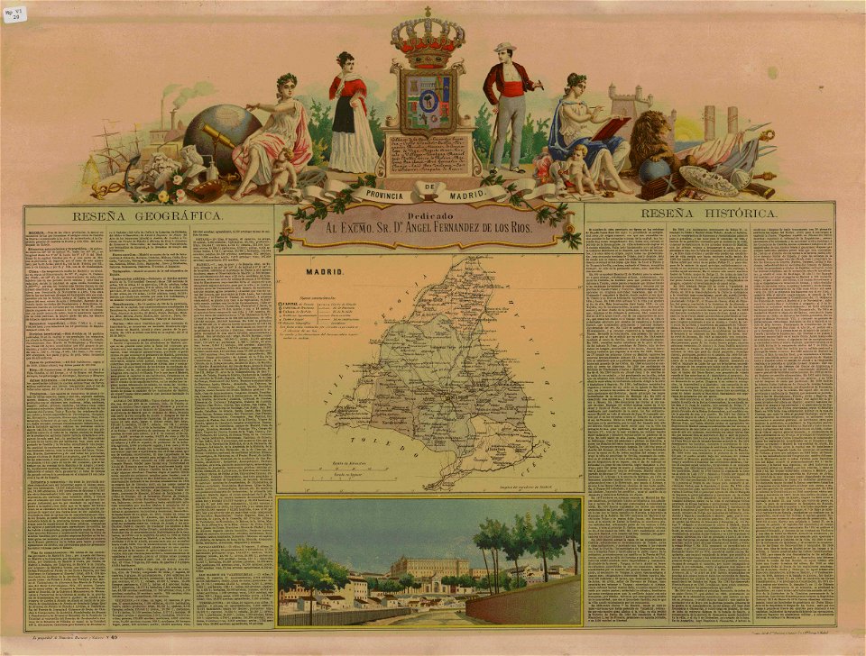
old maps of the community of madrid
1868 maps
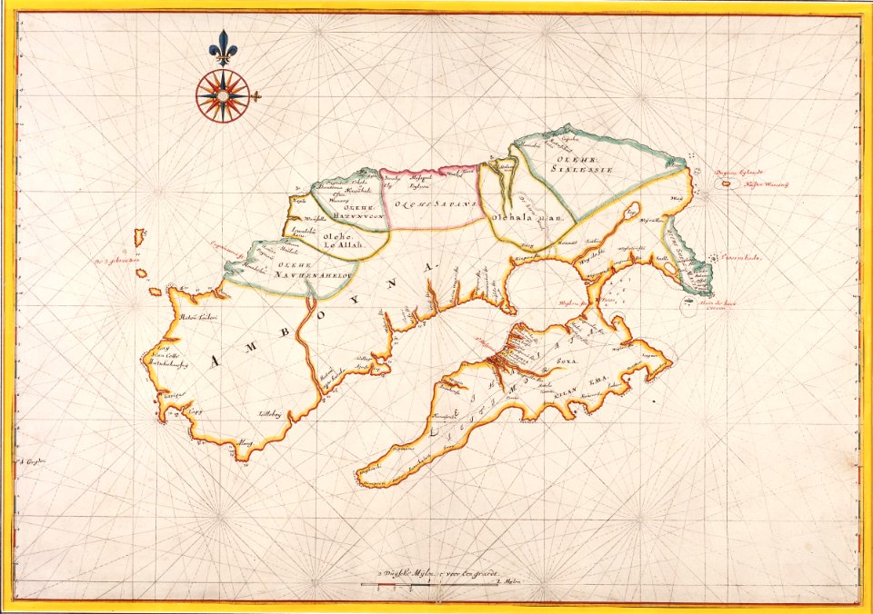
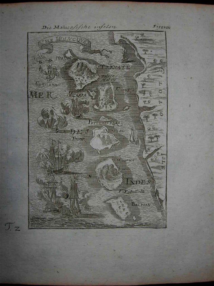
old maps of indonesia
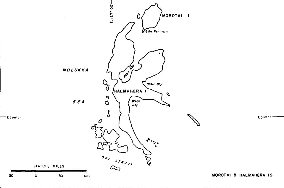
halmahera
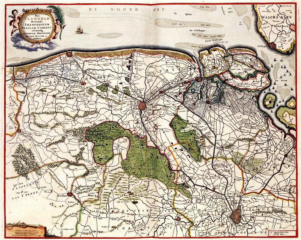
maps by frederick de wit
old maps of flanders
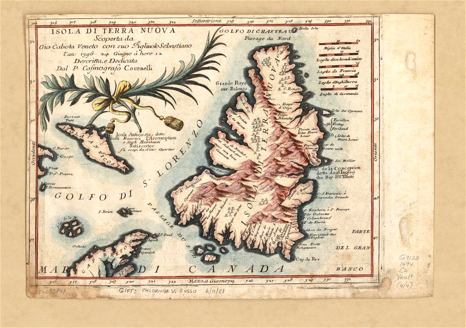
maps by coronelli
pylos
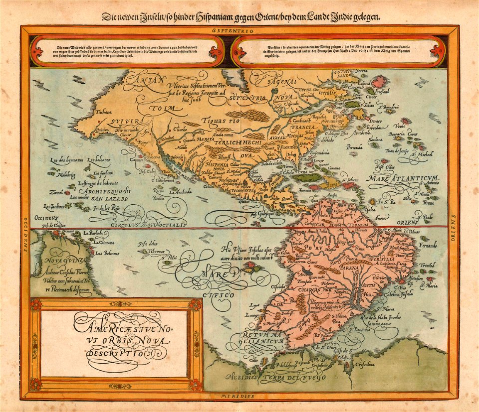
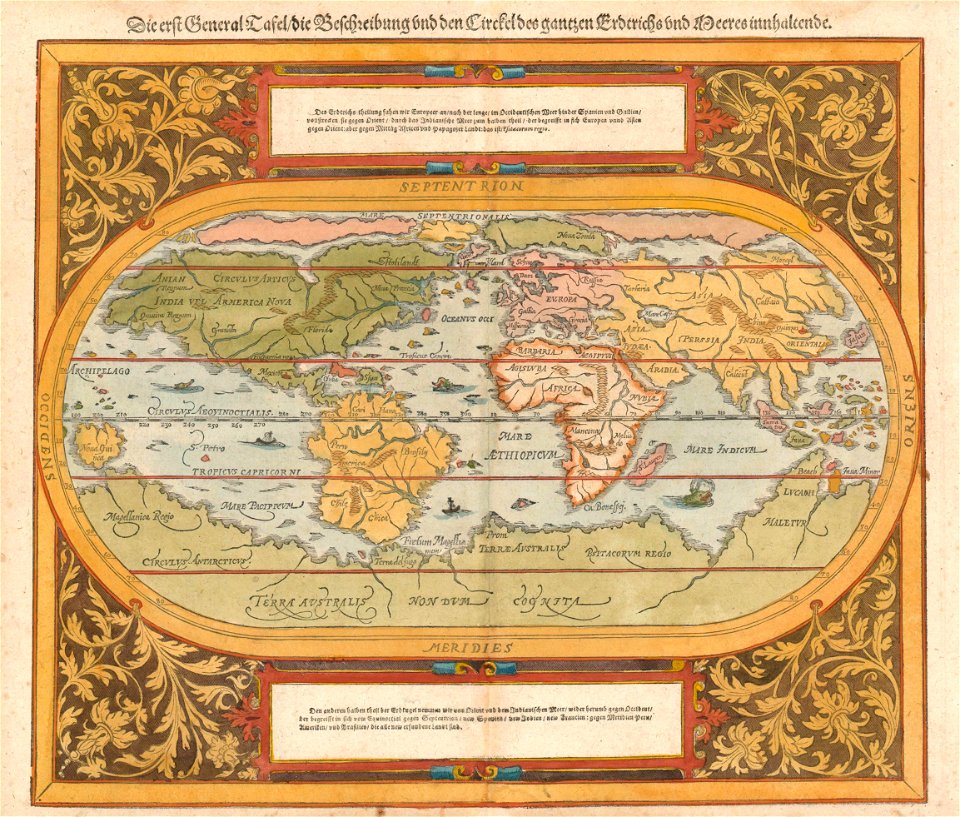
maps by sebastian münster
old maps of the americas
maps by sebastian münster
1590s maps of the world
reichenau island
1627 maps
jacques-nicolas bellin
1764 maps
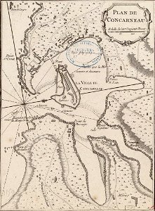
old maps of toulon
toulon naval base
maps by jacob van deventer
old maps of gistel
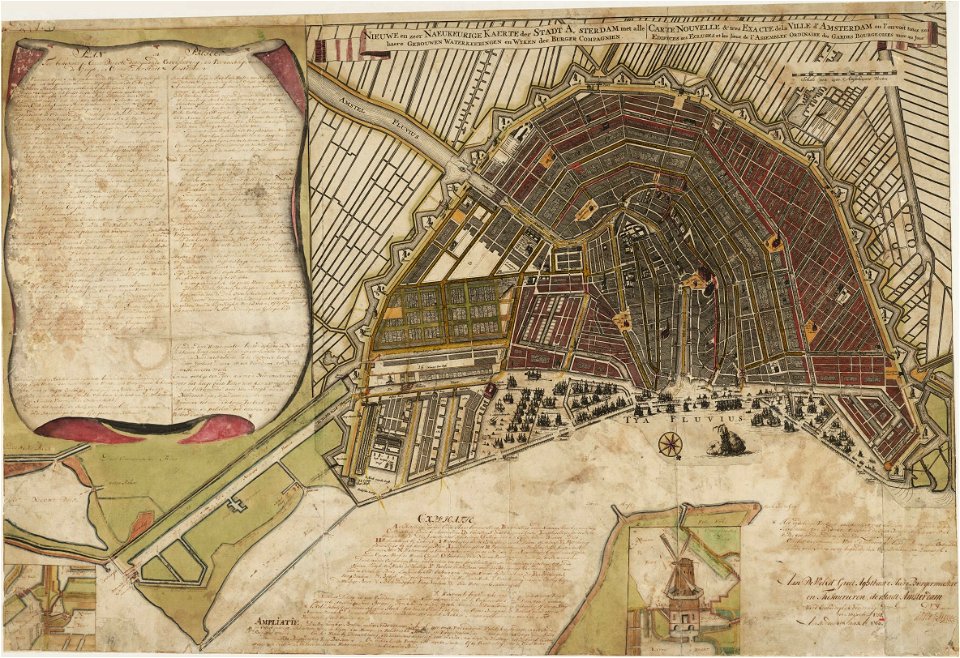
maps in the stadsarchief amsterdam
old maps of amsterdam
newfoundland island
maps by coronelli
maps by jacob van deventer
old maps of friesland
1876 maps
lemuria
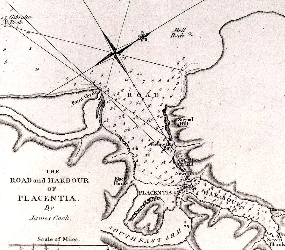
james cook (maps relating to)
old maps of newfoundland
james cook (maps relating to)
old maps of newfoundland
james cook (maps relating to)
old maps of newfoundland
18th-century maps of stockholm
maps of hjorthagen
17th-century maps of stockholm
maps of hjorthagen
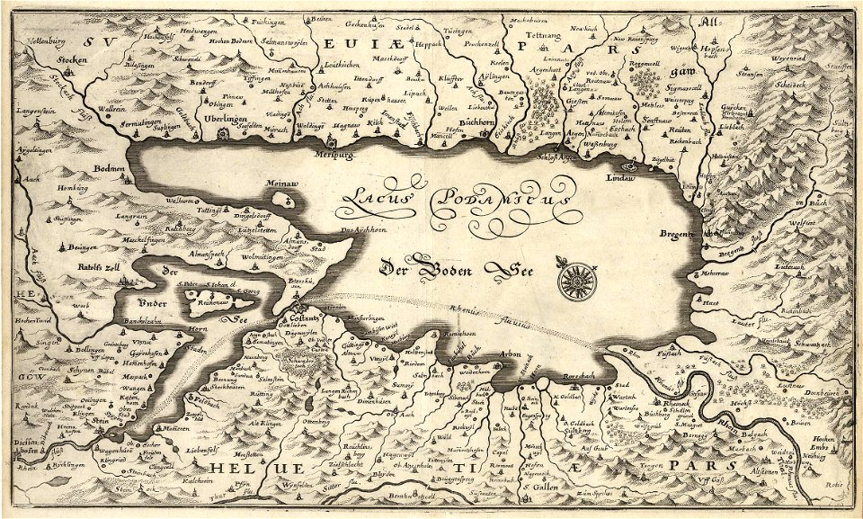
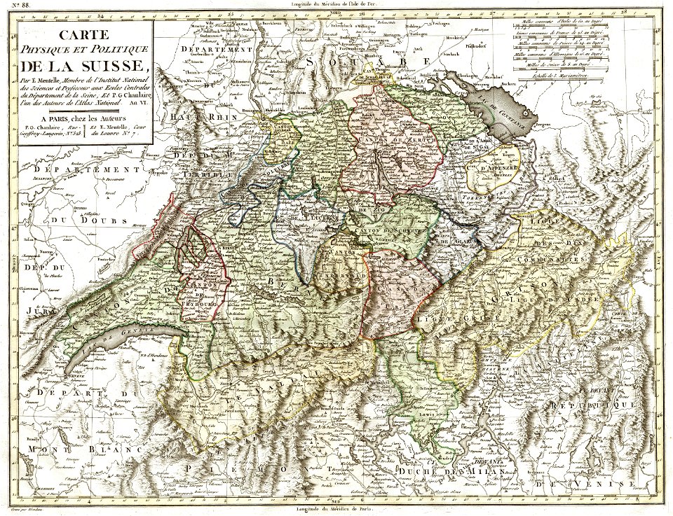
old maps of switzerland
1798 in switzerland
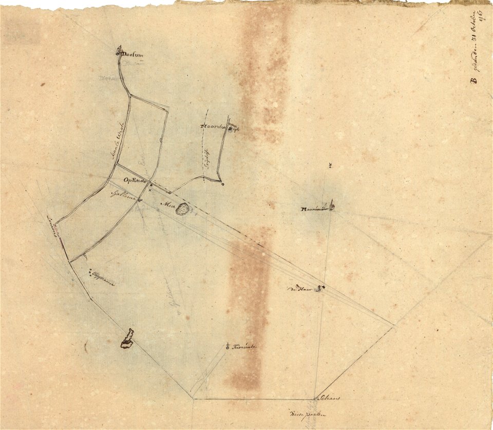
sjallemaheerd (opende)
maps of marum
groningen
nienoord
maps in the rijksmuseum amsterdam
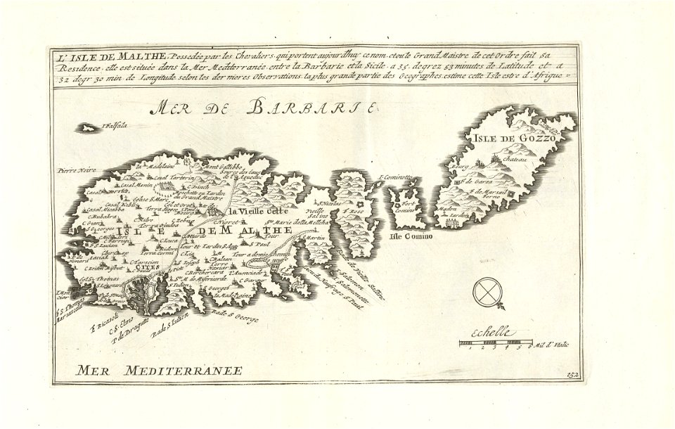
old maps of malta
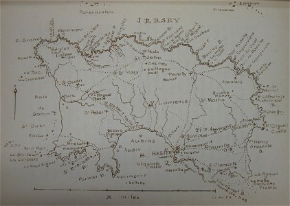
old maps of jersey
1858 maps
maps by jacques-nicolas bellin
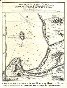
table bay
17th-century engravings
frans post
maps made in the 17th century
gerard valck
17th-century three-quarter view portrait paintings of men
17th-century portrait paintings in the united states
london
dublin
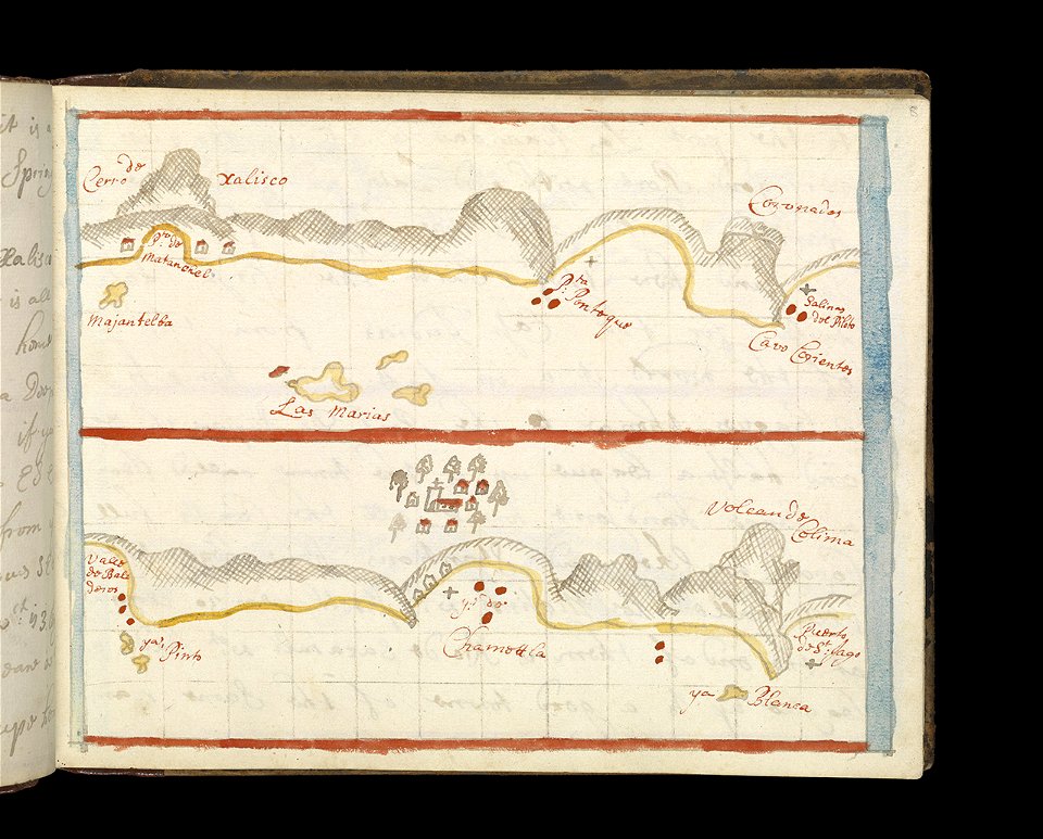
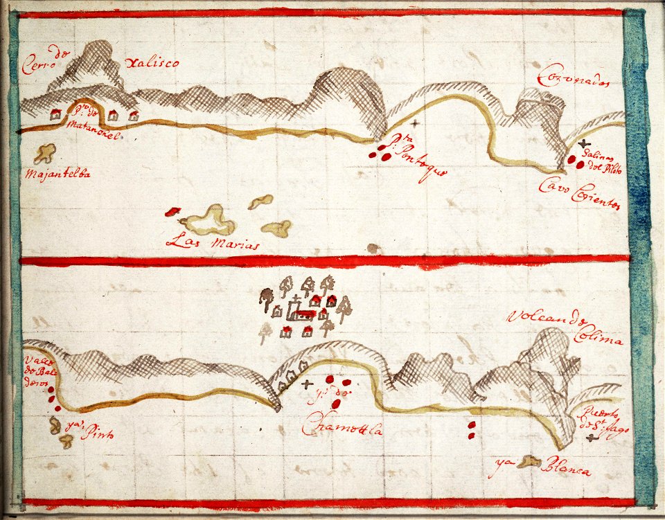
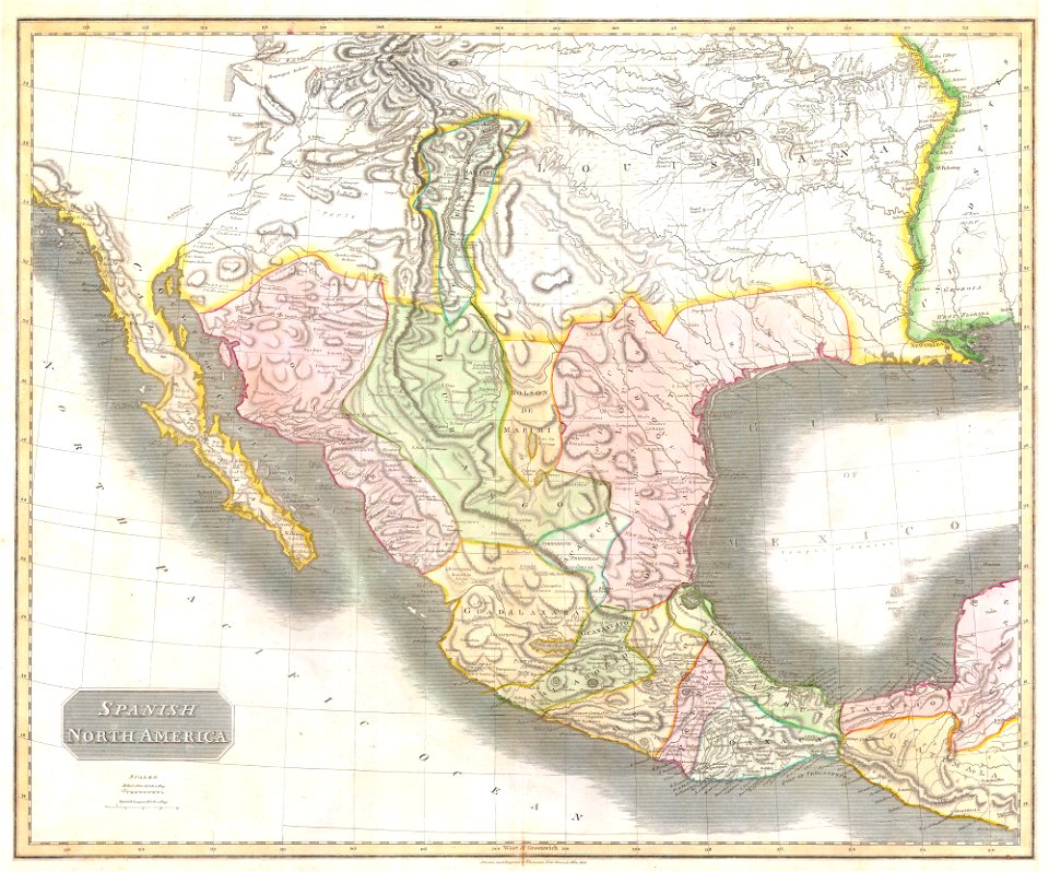
old maps of mexico
pictorial maps
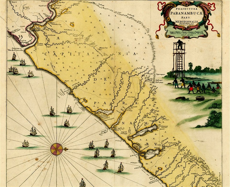
18th-century maps of brazil
1780 in south america
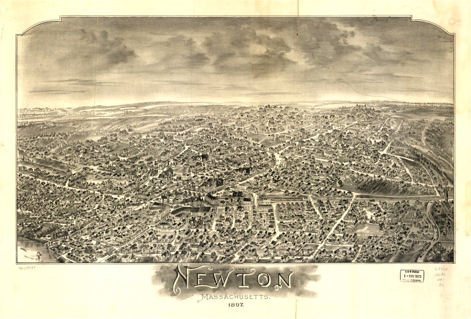
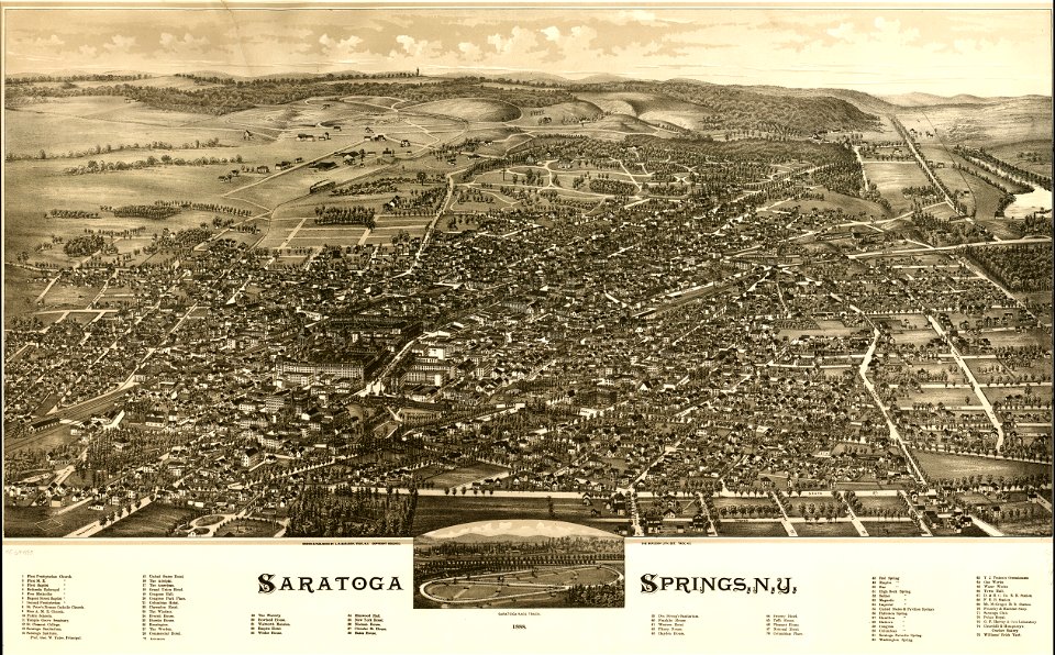
massachusetts
o. h. bailey
massachusetts
o. h. bailey
massachusetts
o. h. bailey
massachusetts
o. h. bailey
massachusetts
o. h. bailey
charts and maps of the royal museums greenwich
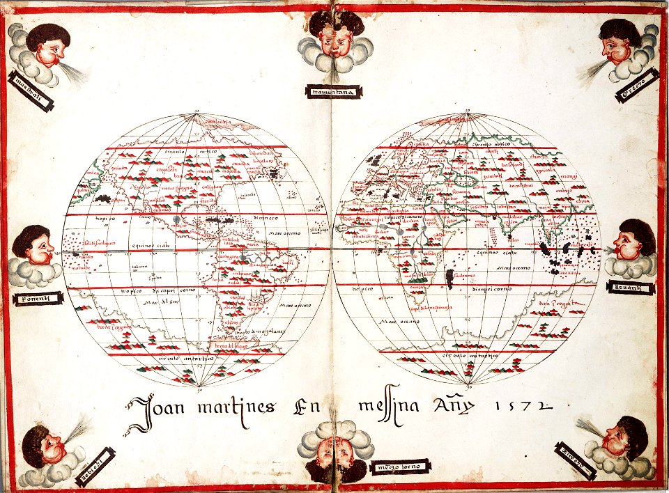
1572 maps
maps in the library of congress
washington
old maps of mexico
jalisco
old maps of mexico
jalisco
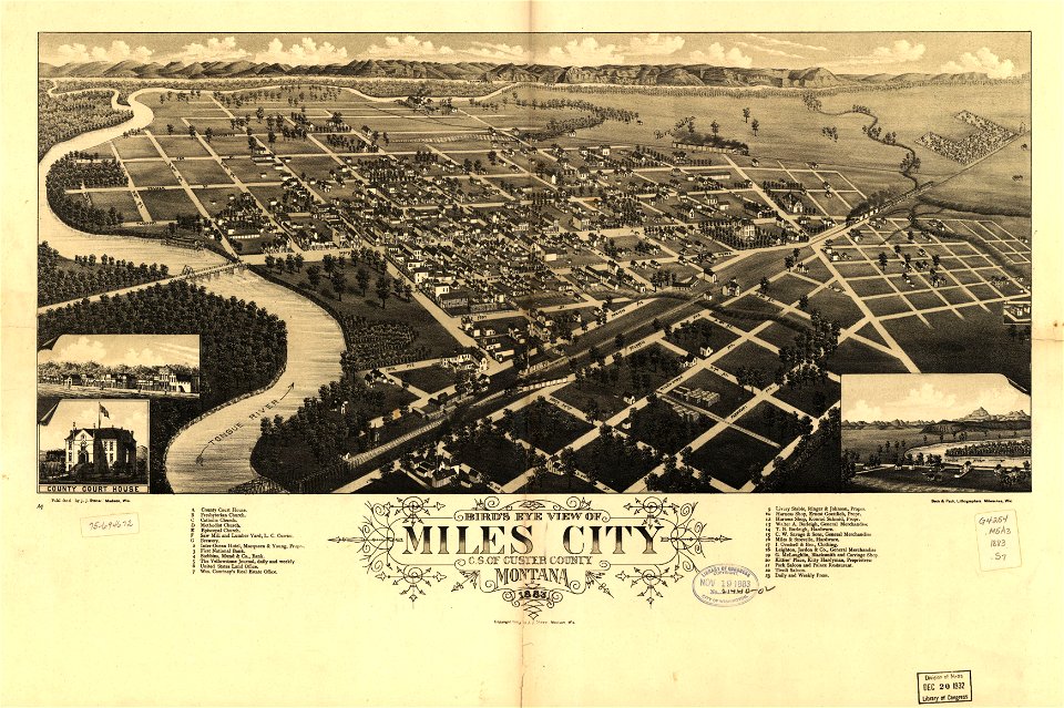
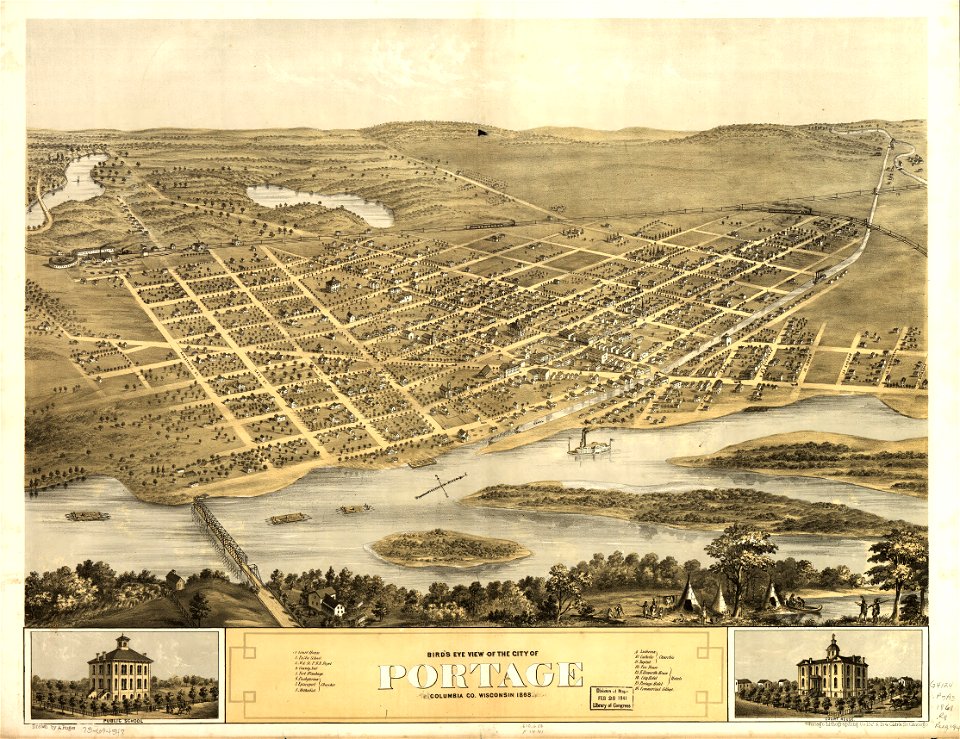
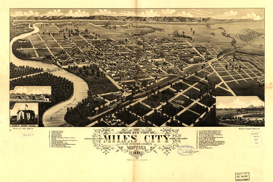
miles city
montana
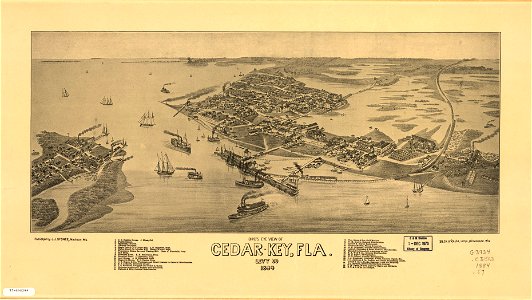
maps in the library of congress
washington
cedar key
florida
maps in the library of congress
albert ruger
miles city
montana
cedar key
florida
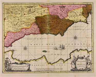
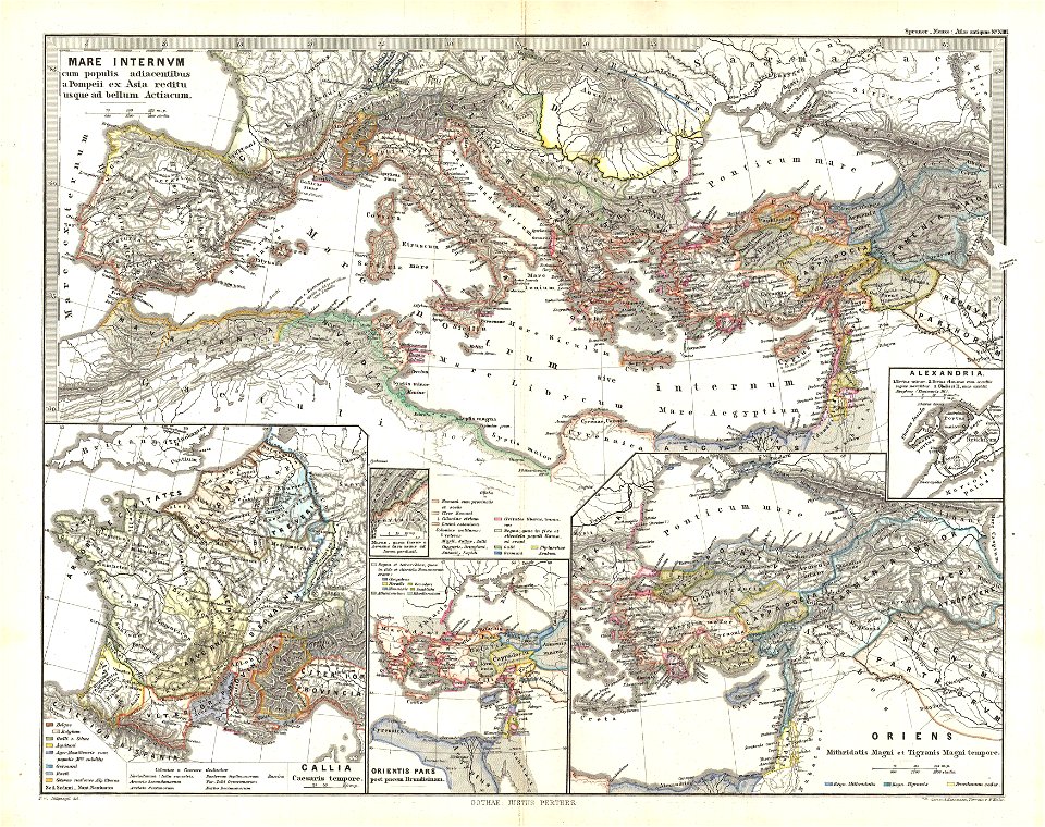
19th-century maps of the mediterranean sea
1865 maps
19th-century maps of the mediterranean sea
1865 maps
maps from the mechanical curator collection
1868 maps
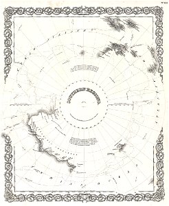
thomas abernethy (explorer)
old maps of antarctica
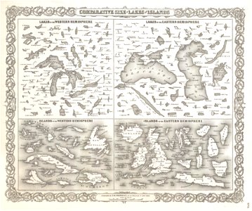
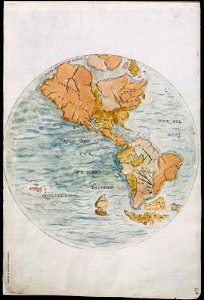
geographic comparison diagrams
1855 maps
geographic comparison diagrams
1855 maps
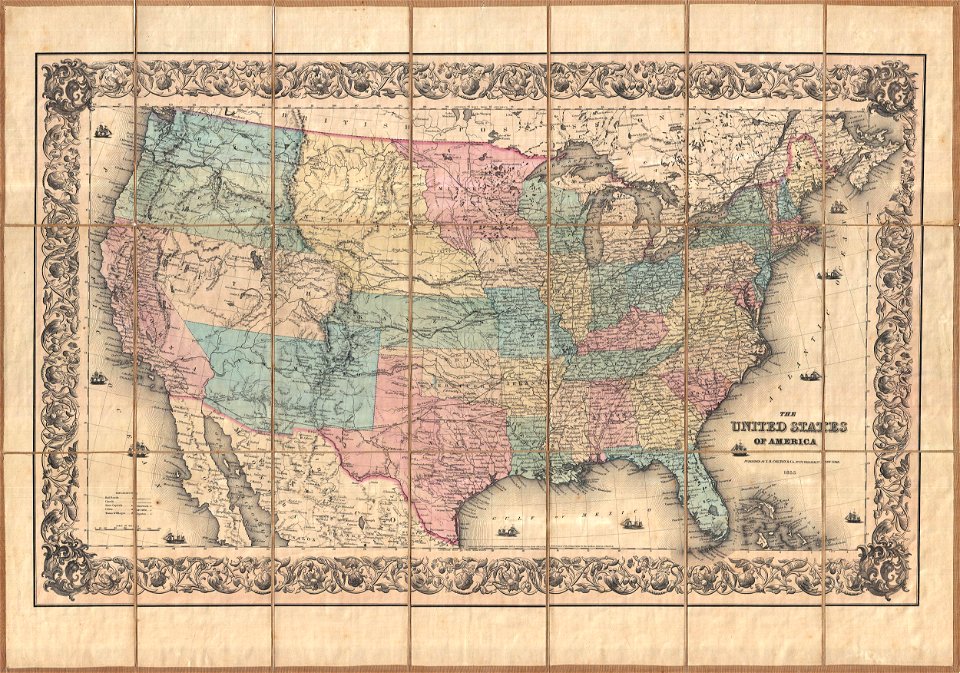
maps by joseph hutchins colton
english-language maps
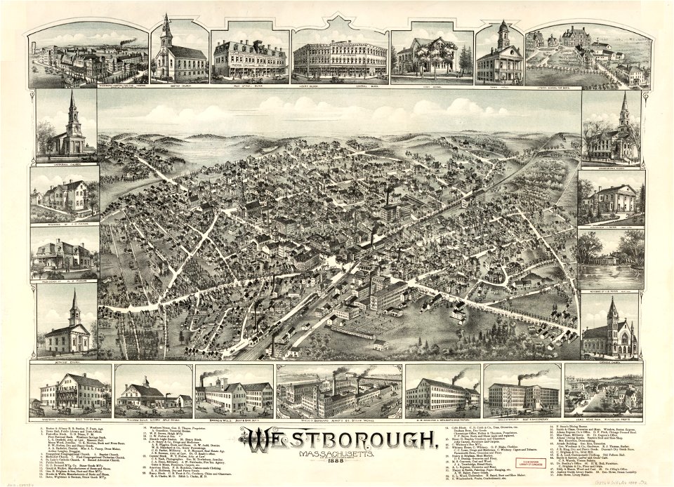
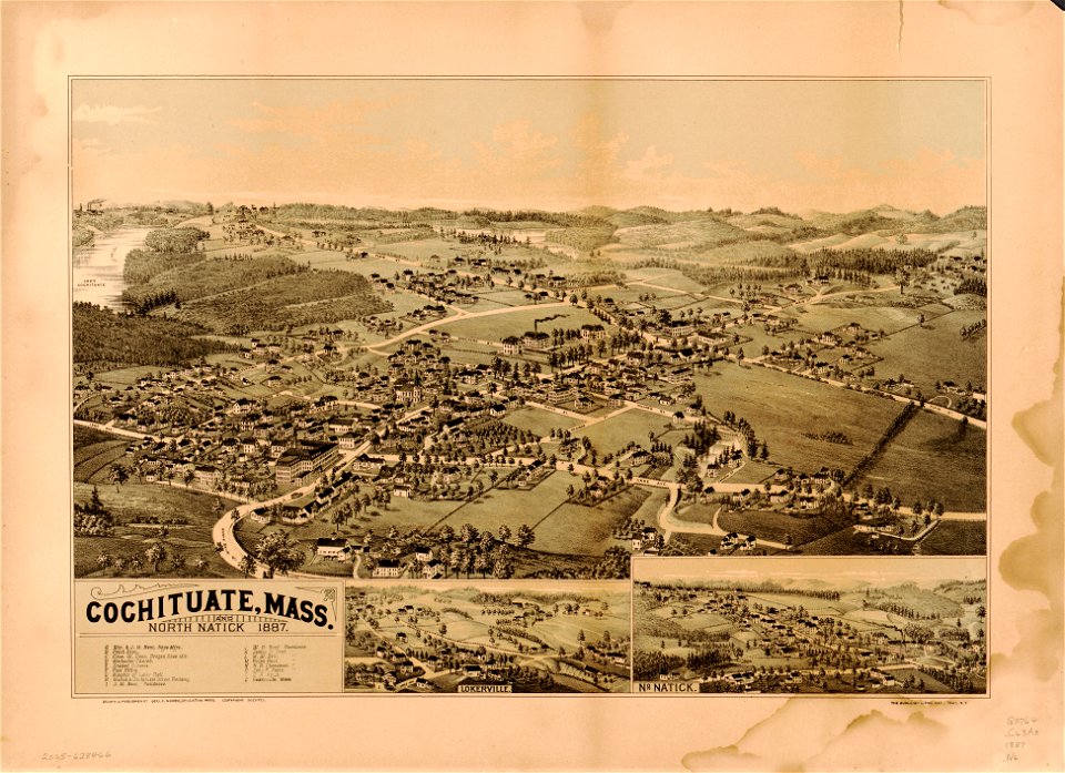
massachusetts
natick
massachusetts
natick
old maps of new york (state)
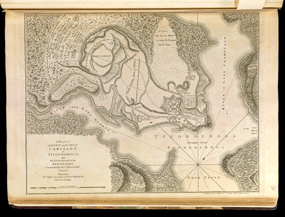
fort ticonderoga
19th-century satirical maps
1870 maps of europe
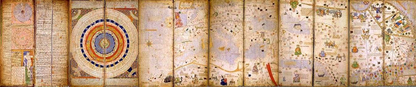
1375 maps of africa
catalan atlas
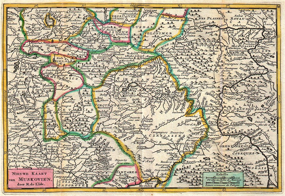
old maps of the russian empire
johannes ratelband
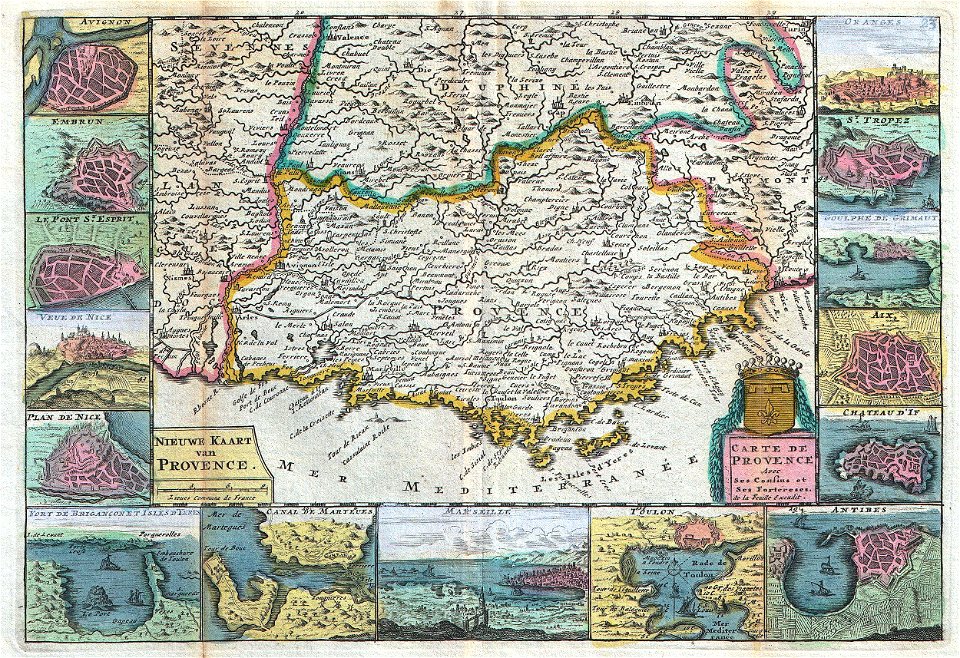
old maps of provence
johannes ratelband
maps by frederick de wit
copper engraving
17th-century maps of indonesia
1665
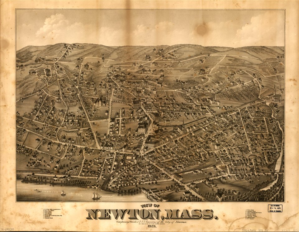
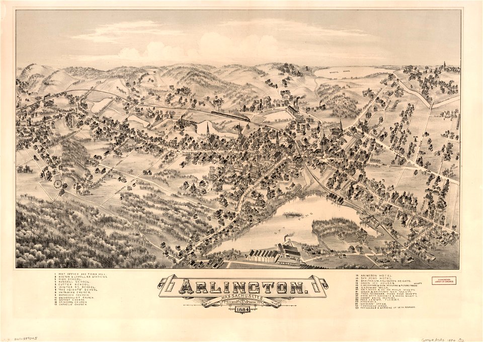
old maps of massachusetts
o. h. bailey
old maps of massachusetts
o. h. bailey
maps by nicolas sanson
1705
francis drake
1577
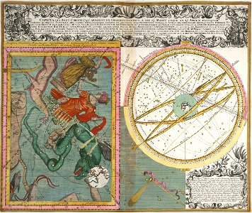
old celestial maps
maps with figures
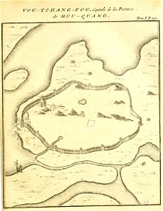
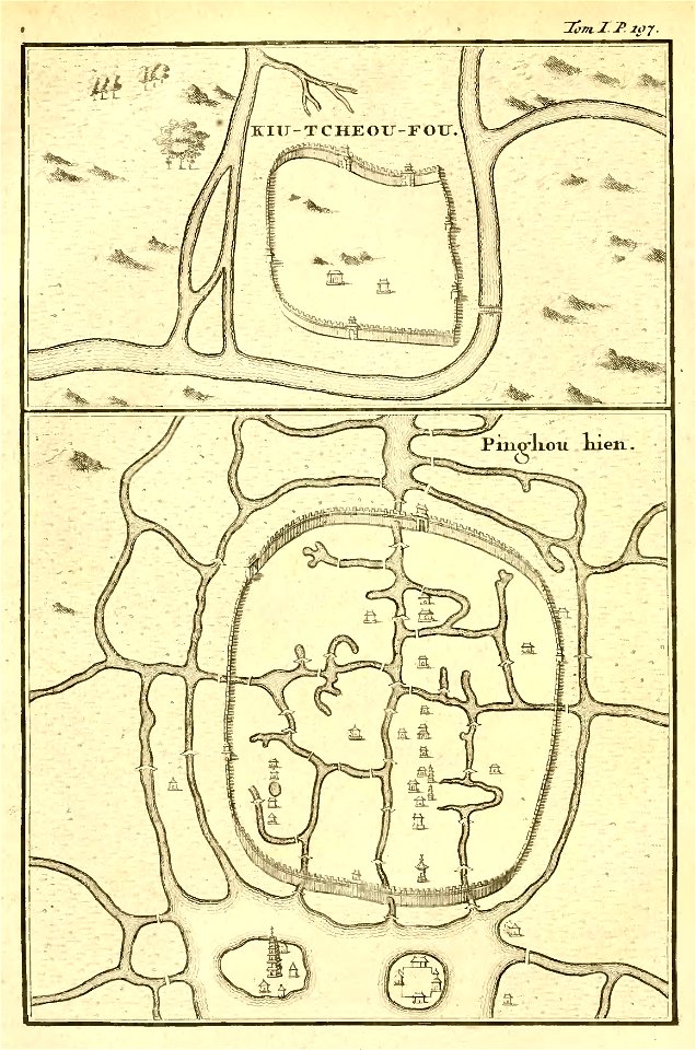
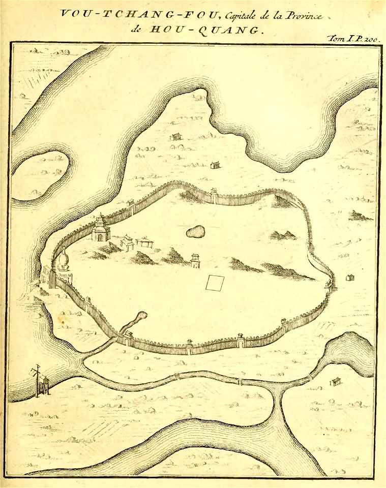
french-language maps of china
old maps of wuhan
french-language maps of china
old maps of zhejiang
french-language maps of china
old maps of wuhan
pleasant hill
missouri
maps in the library of congress
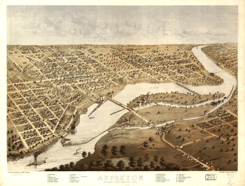
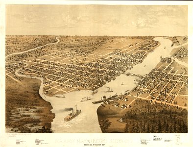
1867 maps
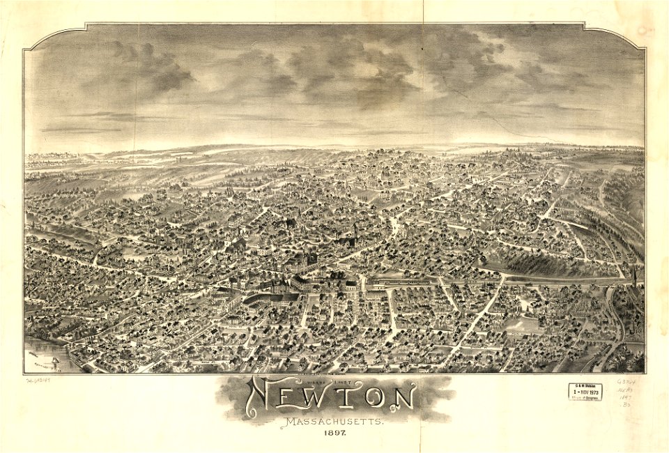
massachusetts
o. h. bailey
1810s maps of mexico
1814 in mexico
charts and maps of the royal museums greenwich
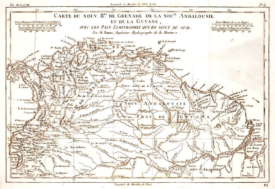
old maps of ecuador
charts and maps of the royal museums greenwich
old maps of ecuador
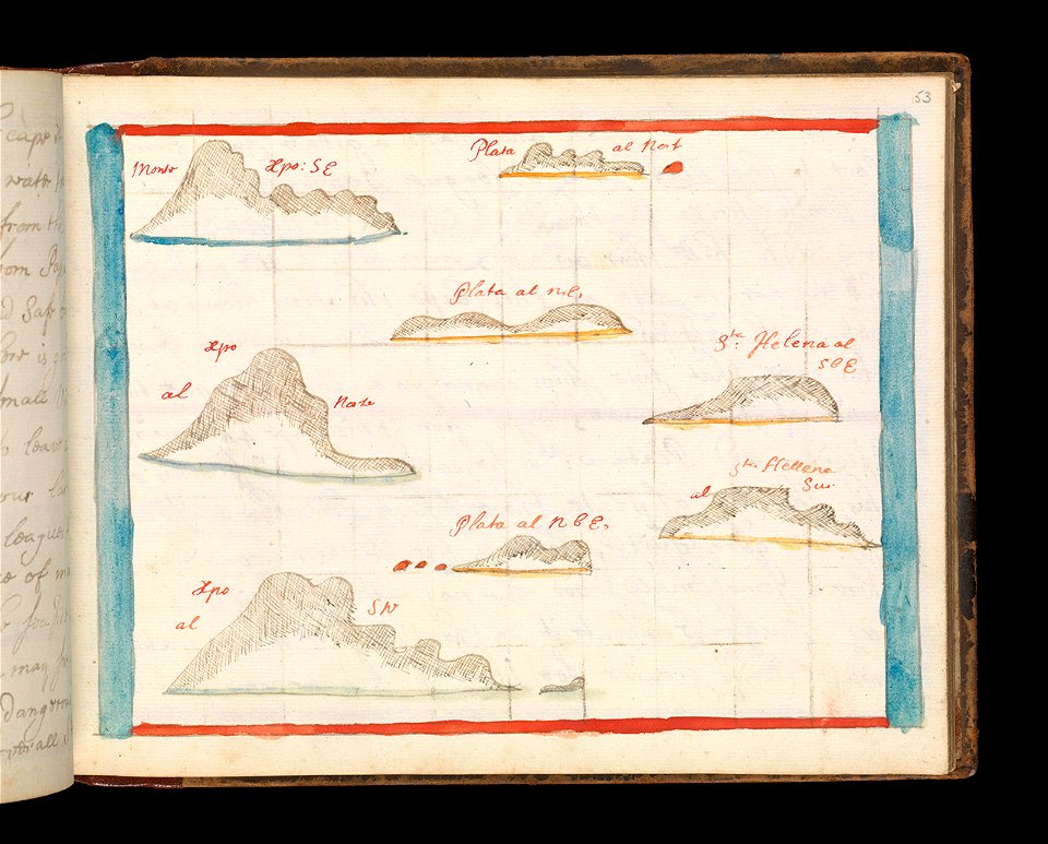
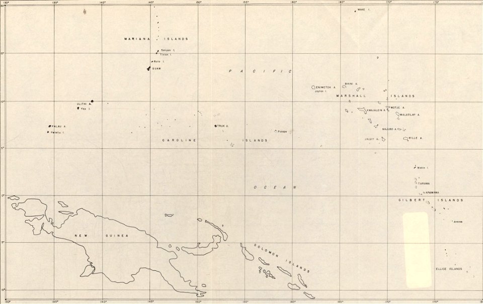
maps of islands of the pacific ocean
old maps of the pacific ocean
17th-century maps of indonesia
description de l'universe
18th-century maps of indonesia
description de l'universe
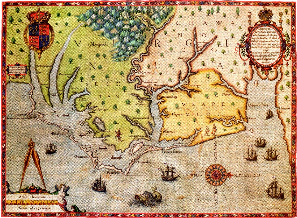
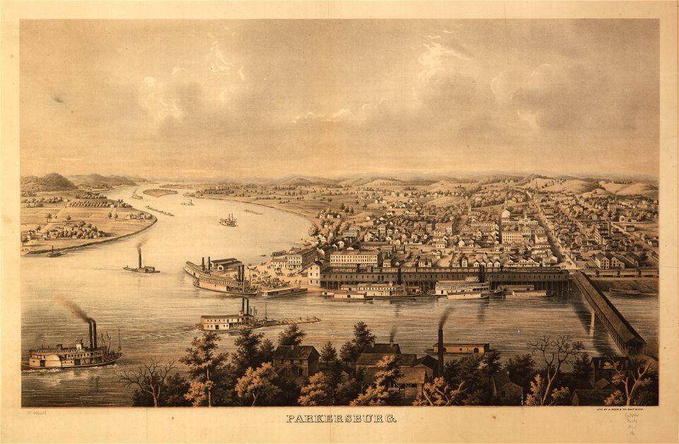
old maps of virginia
theodor de bry
maps in the library of congress
1867 maps
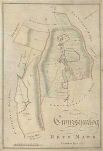
estate maps in the national library of wales
estate maps
old maps of panama
panama
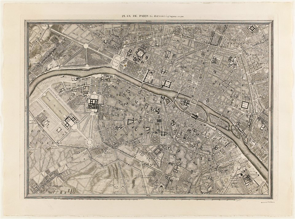
maps of paris from paris musées
plan de roussel
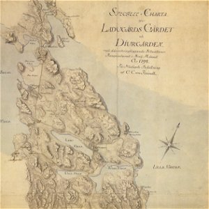
18th-century maps of stockholm
maps of gärdet
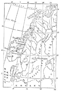
maps of scandinavia
1877 maps
maps in the library of congress
town maps by l. r. burleigh
maps in the library of congress
a. hoen & co.
maps in the library of congress
a. hoen & co.
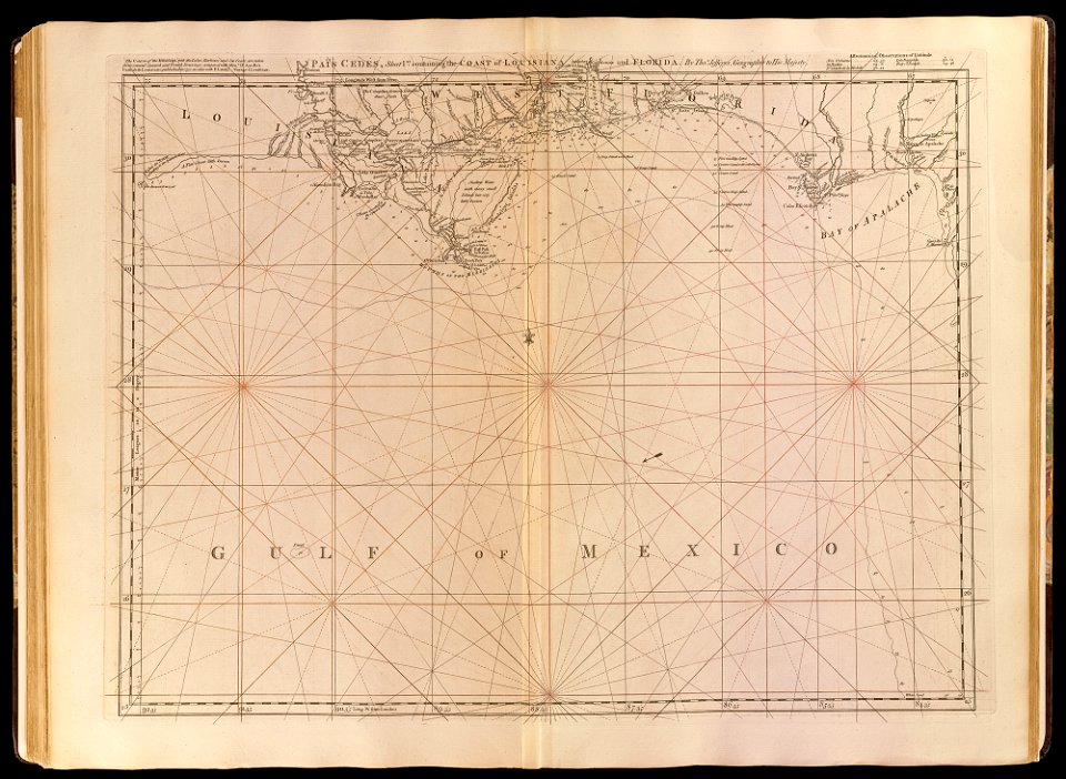
old maps of the gulf of mexico
maps by thomas jefferys
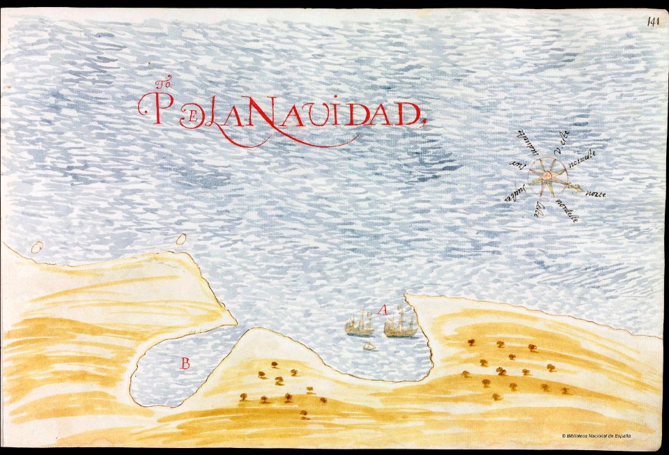
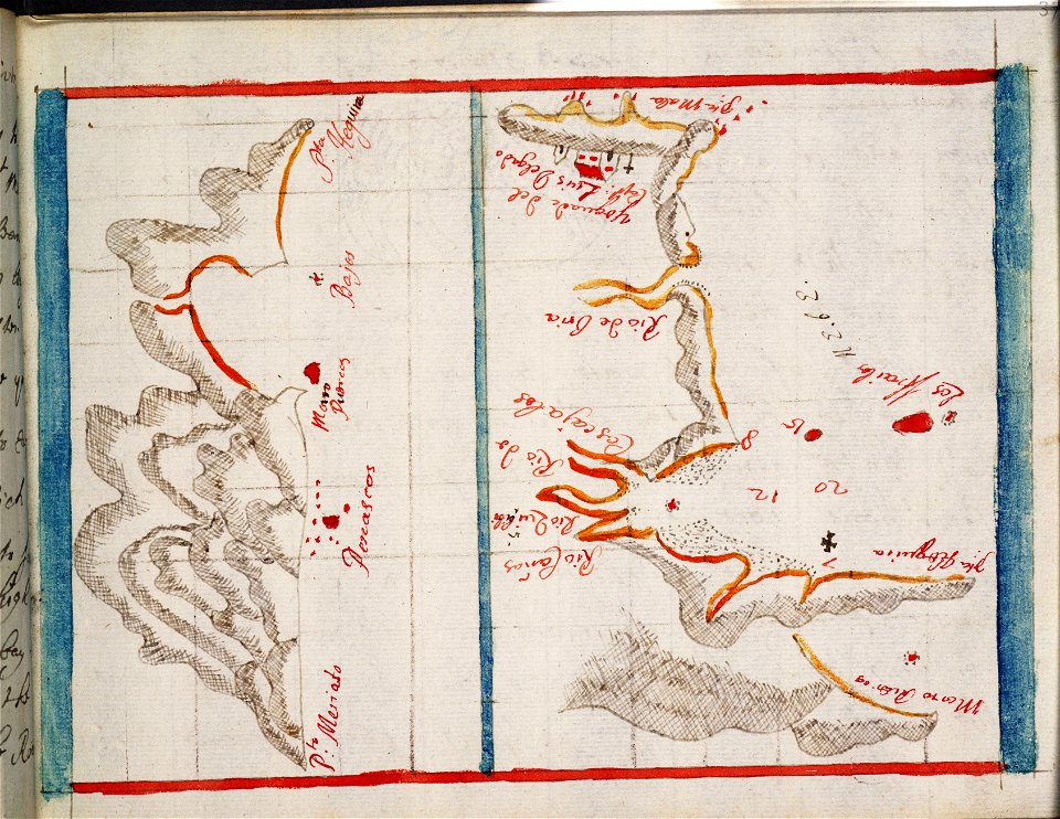
old manuscript maps
pictorial maps
old maps of earth's hemispheres
pictorial maps
2901 - 3000 of 34,645
Next page
/ 347